Let’s dive into the world of map illustration design.
What Is an Illustrated Map?
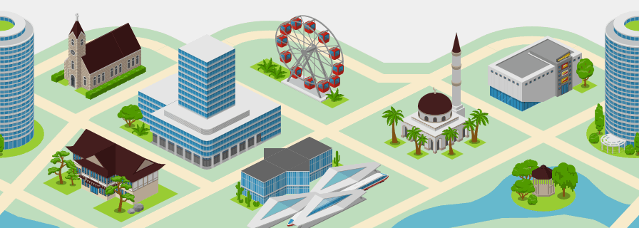
An illustrated map—also known as a pictorial map, panoramic map, or perspective map—is a creative and artistic representation of a place. Rather than focusing on the exact scale and accuracy of GPS, it shows buildings, streets, and landmarks in a way that tells a story.You've probably seen a few examples of illustrated maps! These maps often show places in a three-quarter view, also called a bird’s-eye view map, which helps people see buildings from the side and top at the same time.
Why Are Illustrated Maps So Popular?
Because they’re fun and informative. And let’s be honest—map illustration design just looks cool. You get the information you need, but also a touch of personality.Illustrated maps are:
- Great for orientation: People easily find landmarks and paths.
- Memorable: Who forgets a map full of color and characters?
- Shareable: They’re practically made for social media, flyers, or brochures.
- Customizable: You can design them in your company colors and add logos or even mascots!
How to Create an Illustrated Map (Without Drawing!)
You don't need to be a professional artist to make your own map. Using Icograms Designer — an illustrated map generator — you can create stunning visuals online with drag-and-drop simplicity. All you need to create a map illustration design is your idea.With Icograms, you can design panoramic cityscapes, theme park guides, or smart city layouts in minutes. You can:
- Choose from hundreds of icons, buildings, and landmarks.
- Arrange them in your layout in an isometric view.
- Add your custom labels, colors, and logos.
- Export your artwork to a variety of graphic formats.
Where You’ve Seen Illustrated Maps
Here are a few popular illustrated map examples you’ve probably come across:
- Theme park maps with roller coasters, snack stalls, and cartoon mascots.
- University campuses that highlight dorms, libraries, and dining halls.
- Historical city maps from the Renaissance showing bustling marketplaces and steeples.
- Tourist maps in hotels and brochures, marking out must-see sights.
Where Design Meets Technology
With our online map creator, you can combine traditional storytelling with digital ease. It’s like combining a sketchbook with a smart editor. You can:
- Save multiple versions.
- Reuse icons or templates.
- Export for print, web, or social.
Ready to Start Your Own Illustrated Map?
Let’s take a look at Icograms Designer, an illustrated map generator. It’s perfect for:
- Business owners or marketing managers looking to create “You Are Here” maps.
- Event organizers designing user-friendly layouts.
- Teachers helping students create projects with flair.
- Urban planners, game developers, or even wedding coordinators.
So, are you ready to become a mapmaker and see your city, school, or story come to life? Start drawing. Start dreaming. And let an illustrated map do the rest.


